GNSS RTK Rover Built GPS RTK Base
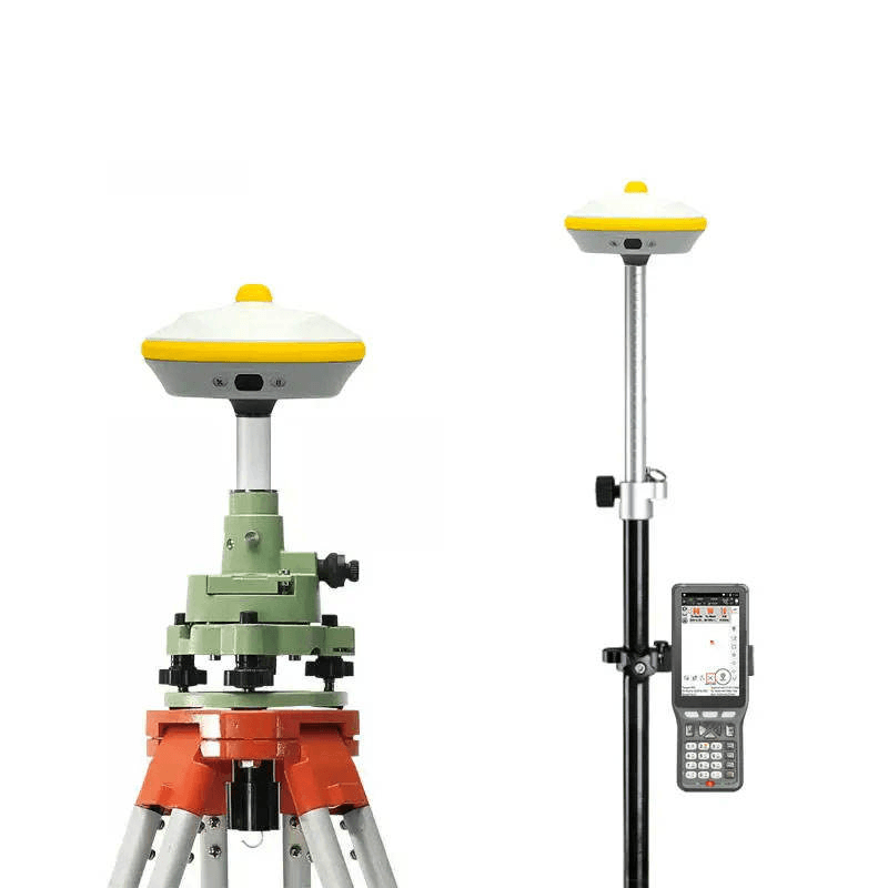
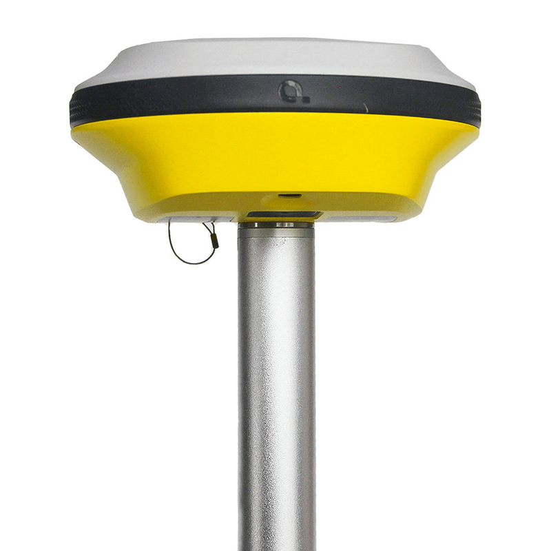

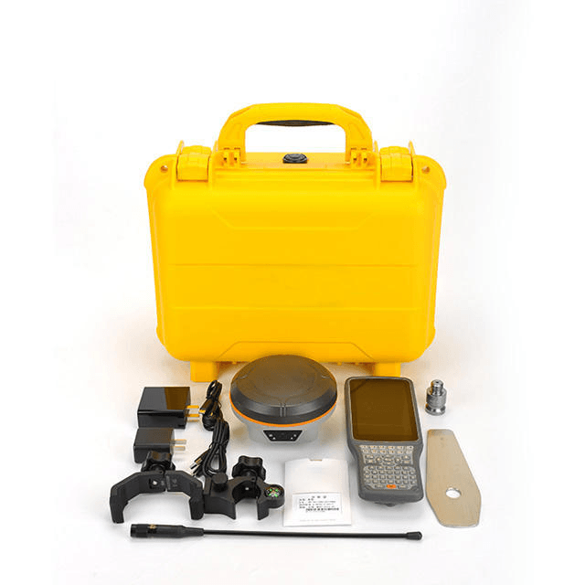
Visual stakeout RTK integrates CTI’s new visual technology, which supports visual real-scene stakeout. The stakeout points are directly marked on the ground, and the points are placed in place with one rod. There is no need to move the rod back and forth. Equipped with a starlight-level camera, you can see clearly when there are stars. Satellite navigation + inertial navigation + visual fusion algorithm replaces the magnetic compass solution, is not subject to magnetic interference, and indicates accurate directions. 1400 channels, fixed effect increased by 15% in occlusion environment. The CCT 5-star 21-frequency calculation engine has been upgraded, the chip computing power has been increased by 100%, and more satellite frequency points can be solved. At the same time, it supports continuous testing without network, and can test when the network is interrupted. It focuses on solving the pain points of weak and unstable network signals in forest areas, cross-provincial junctions, etc., greatly improving the usability of RTK
| Color | yellow |
|---|---|
| Weight | 7KG |
| Dimension | 1m x 0.65m x 0.3m |
Details About GNSS RTK Rover Built GPS RTK Base
Product Paramenters
|
Rover
|
||
|
project
|
content
|
index
|
|
Satellite tracking
|
Satellite system
|
GPS+BDS+Glonass
|
|
Support three generations, support Five star 21 frequency point
|
||
|
Satellite tracking
|
BDS: B1I,B2I,B3I,B1C,B2a,B2b*
|
|
|
GPS: L1C/A,L1C,L2C,L2P,L5
|
||
|
GLONASS: G1,G2,G3
|
||
|
Galileo: E1,E5a,E5b,E6*
|
||
|
QZSS: L1C/A,L1C,L2C,L5
|
||
|
IRNSS: L5*
|
||
|
SBAS: L1C/A*
|
||
|
Channel
|
1400
|
|
|
Initialization reliability
|
99.99%
|
|
|
No network continued test
|
support
|
|
|
Signal acquisition sensitivity
|
Typical value -152 dbm, the ability to capture weak signals is stronger
|
|
|
Accuracy
|
Static accuracy
|
Planar accuracy:±(3.5mm + 0.6×10⁻⁶×D)mm
|
|
Elevation accuracy:±(6mm + 0.5×10⁻⁶×D)mm
|
||
|
RTK accuracy
|
Planar accuracy:±( 8mm + 1×10⁻⁶×D)mm
|
|
|
Elevation accuracy:±(15mm + 1×10⁻⁶×D)mm
|
||
|
Tilt compensation accuracy
|
8mm + 0.3mm /° tilt (accuracy <3.5cm within 40°)
|
|
|
Video measurement accuracy
|
Typical 2~4cm, measuring distance 2~ 12m
|
|
|
GNSS+ Inertial navigation
|
IMU update rate
|
150Hz
|
|
Tilt Angle
|
0-45°
|
|
|
Insensitive super inertial navigation
|
No initialization is required, the INS will not exit after initialization
|
|
|
User interaction
|
Pilot lamp
|
1 satellite light +1 differential data light +1 static indicator light +1 power light
|
|
key
|
Static switch button + Power/Confirm button
|
|
|
web page
|
Support PC/ mobile web page
|
|
|
camera
|
Characteristic function
|
Video measurement, efficiency increase by 60%*
|
|
3D modeling, double the efficiency of internal and external work *
|
||
|
AR real navigation, put a point not lost
|
||
|
Visual lofting, one stick in place
|
||
|
pixel
|
2MP&5MP
|
|
|
Frame rate
|
20Hz
|
|
|
Field of view (H, V)
|
75°,75°
|
|
|
illuminance
|
Starlight camera, OmniPixel 3-GS technology
|
|
|
Full color picture at 0.01lux
|
||
|
Physical characteristics
|
dimension
|
Φ133.5mm*80mm
|
|
weight
|
720g (battery included)
|
|
|
material
|
Magnesium alloy
|
|
|
Operating temperature
|
-45℃~+70℃
|
|
|
Storage temperature
|
-55℃~+80℃
|
|
|
Waterproof and dustproof
|
IP68 (30 minutes underwater 1 meter immersion)
|
|
|
anticollision
|
IK08 (subjected to the same mechanical impact as the 2.5kg steel ram without damage, resistance to 3m drops)
|
|
|
anti-condensation
|
100%
|
|
|
upgrade base
|
||
|
project
|
content
|
parameter
|
|
Receiver characteristics
|
satellite tracking
|
GPS+BDS+QZSS, support Beidou third-generation satellites, support five-star sixteen-frequency
|
|
operating system
|
LINUX operating system
|
|
|
number of channels
|
1400 channels
|
|
|
Initialization time
|
<4s (typ.)
|
|
|
Initialize reliability
|
>99.99%
|
|
|
Receiver appearance
|
button
|
1 dynamic/static switch key, 1 power key
|
|
indicator light
|
1 differential signal light, 1 satellite light, 1 static data acquisition light, 1 power light
|
|
|
Nominal accuracy
|
static precision
|
Plane accuracy: ±(3.5+ 0.6×10⁻⁶×D) mm
|
|
Elevation accuracy: ±(6+0.6×10⁻⁶×D) mm
|
||
|
RTK accuracy
|
Plane Accuracy: ±(7 + 1×10⁻⁶×D) mm
|
|
|
Elevation accuracy: ±(16+ 1×10⁻⁶×D) mm
|
||
|
Stand-alone accuracy
|
1.5m
|
|
|
Code differential accuracy
|
Plane Accuracy: ±(0.26 + 1×10⁻⁶×D) m
|
|
|
Elevation accuracy: ±(0.6+ 1×10⁻⁶×D) m
|
||
|
GNSS+Inertial Navigation
|
IMU
|
200Hz
|
|
slope
|
0~50°
|
|
|
Tilt compensation accuracy
|
10mm+0.7mm/°tilt (accuracy within 30°<2.5cm)
|
|
|
Electrification parameters
|
Battery
|
Built-in 6300mAh lithium battery, support 15 hours battery life of mobile station
|
|
External power supply
|
Support external power supply via USB port
|
|
|
physical properties
|
Size (L*W*H)
|
119mm*119mm*85mm
|
|
weight
|
0.70kg
|
|
|
Material
|
Magnesium alloy AZ91D body
|
|
|
Operating temperature
|
-45℃~+70℃
|
|
|
storage temperature
|
-55℃~+80℃
|
|
|
Waterproof and dustproof
|
IP68 class
|
|
|
shock shock
|
IK08 class
|
|
|
Anti-drop
|
Resist 2 meters free fall
|
|
|
data output
|
output format
|
NMEA 0183, binary code
|
|
output method
|
BT/Wi-Fi/Radio
|
|
|
static storage
|
storage format
|
Can directly record HCN, HRC, RINEX
|
|
storage
|
Standard 8GB built-in storage
|
|
|
Download method
|
Universal USB data download; HTTP download
|
|
|
data communication
|
I/O interface
|
1 external UHF antenna port
|
|
1 USB-TypeC interface, support charging, power supply, data download
|
||
|
network module
|
Handbook supports 4G full Netcom
|
|
|
Radio station
|
Built-in high frequency 450-470MHz single receiver radio
|
|
|
protocol
|
TT400
|
|
|
Blue tooth
|
BT4.0, backward compatible with BT2.x, compatible with Windows, Android, IOS systems
|
|
|
data transmission
|
Wi-Fi data link
|
|
|
Wi-Fi
|
802.11 b/g/n
|
|
|
NFC
|
Support NFC flash connection
|
|
|
Receiver function
|
super double
|
Support radio + network two-way data differential at the same time
|
|
One-click match
|
Support handbook software to match base station data with one key
|
|
|
Remote upgrade
|
Support one-key remote upgrade
|
|
|
Handbook parameters
|
model
|
300 Android Measurement Handbook
|
|
The internet
|
4G full Netcom, built-in eSIM
|
|
|
operating system
|
Android 11
|
|
|
CPU
|
Octa-core 2.0Ghz processor
|
|
|
LCD screen
|
5.6” HD display
|
|
|
Battery
|
12 hours of battery life
|
|
|
Waterproof and dustproof
|
IP67
|
|
Product Display
Share GNSS RTK Rover Built GPS RTK Base With Your Clients
Related products
-
Surveying Instruments
High Class Total Station Tianyu CTS-632R10M Measurement Surveying Equipment
Read more

